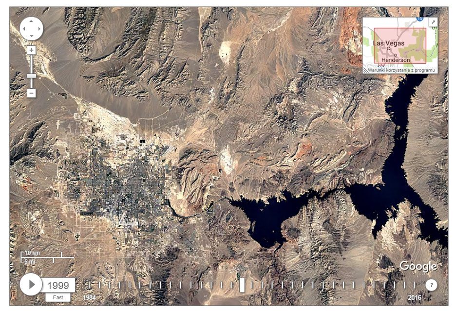
Photo, made with 1984 by 2016 year show every corner of the Earth – then how it changes naturally and by human.
If you are interested in how the land has changed over the past 32 , we invite you to a page Google Timelapse. On this service engine is used Google Earth Engine (should not be confused with the application “Google Earth“), which represents the base of the photos taken with the visualization of the earth 1984 years before 2016 of the year. These photos can be viewed online, at different speed levels.
Below is a video playback button in slow motion you have a button, with which you select one of the three speed modes. You can also manually scroll through the images using the slider. Below you can see how over the years, expanded the city of Dubai in the three viewing modes.
instructive presentation
Google Timelapse allows you to track changes in the appearance of the surface of the earth, a long-time. Visual map was created from more than 5 millions of satellite images (including almost 4 Terapikseley data), most of which performed Landsat satellite. The map can be zoomed in to a rather large degree of, but because of the huge amount of data and the need to preserve liquidity presentation, Google decided to limit the maximum resolution. This is not the same, to which users are accustomed to using Google Maps or Earth, though, and so it is very instructive presentation.
What conclusions can be made from it? only negative, that involve, что наша планета находится в опасности из-за динамично развивающейся цивилизации, or others? While viewing the image, you can clearly see how the city expanded, there were new road, growing careers or changing shorelines of rivers.
Photos are averaged, lacking a clear idea every year, so it's hard to keep track of changes in the scale of months (to some extent this is possible on site Nasa WorldView, но там представлены только последние 4 of the year). Although it is not necessary to hide that it would be very interesting. Many would want to watch the diminishing ice, or deforestation, these things, which at first glance do not usually catch the eye. Живя в Украине, we may not even notice these changes, Only if we look at the situation in a long time scale.
Most deforestation is not evident in the Ukraine and in the Amazon region, which shows how much the forests have been cut down in the past 32 of the year. It is also seen, increasing the radius of the Sahara or the deterioration state of the Aral Sea, that despite the attempts, не удается сохранить в предыдущем размере. The Aral Sea is an example of the destructive uncontrolled use of natural resources, and climate change.
It should show the interactive map to your children. It would thus not only be interesting but also informative, because they learn about why you should protect the environment and use energy-saving technology.


